How GAMMA AR Brings GNSS to the Construction Site

Table of Contents
Share this post
GNSS for positioning of BIM models in the construction of Civil works and Infrastructural Projects
GNSS, or Global Navigation Satellite System – as one of the commonly used location or positioning methods in construction, uses one or multiple constellation of satellites in space that continuously provides precise positioning and navigation. GNSS receivers on the ground accurately determine their real-time position on Earth in three dimensions (latitude, longitude, and altitude).
Today, GNSS is widely used by surveyors on building and infrastructure projects to capture accurate positioning data across the jobsite.
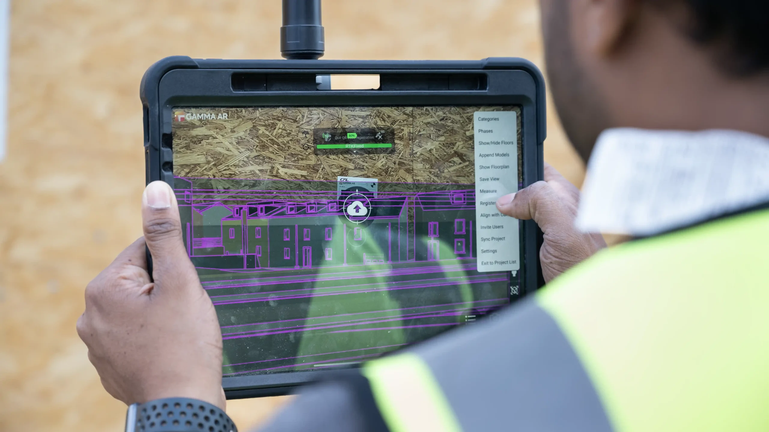
“The utilization of this technology – which is an industry standard – ensures GAMMA AR can utilize GNSS positioning to automatically align geo-referenced 3D/BIM models directly onto the physical construction site and ensure precise overlay in wide-ranging situations, from civil projects over building projects in early phases to linear infrastructural projects such as roads, railways and bridges,” Says Jayan
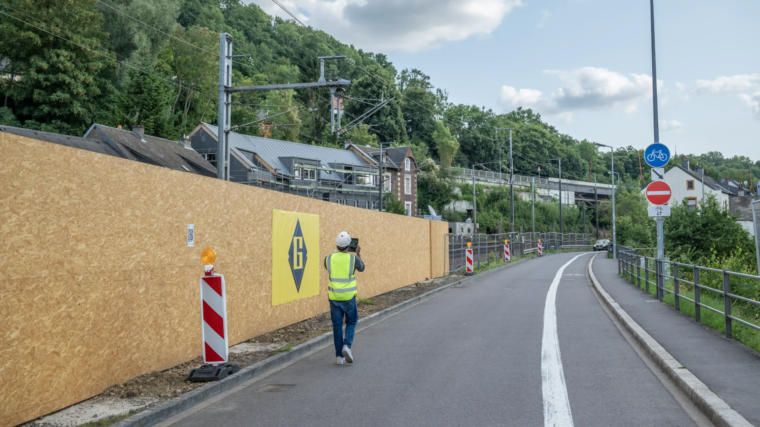
GNSS enables Augmented Reality implementation in outdoor conditions
“Users can navigate large outdoor sites with precise AR overlays with the model perfectly knowing its position in space omitting the needs for alignment references and markers, reducing implementation barriers in many projects,” adds Jayan.
“We have many customers, especially owners such as railway companies, that manage projects which include both buildings and infrastructure such as railway stations, railway-tracks and power lines. They need a solution that lets them move freely in, out, and around stations without interruption. With the new capabilities of GAMMA AR, our AR solution will provide its capabilities to many more civil and infrastructural projects.”
GAMMA AR is a solution build for construction works in and outdoors
“GNSS is a game changer for outdoor AR alignment!” exclaims Jayan. “In Infrastructural projects walls and columns are not frequently available for positioning as they are in vertical construction projects. With GNSS and RTK, the alignment is done automatically which facilitates the usage. Now, GAMMA AR can handle positioning in all types of situations no matter if works are done indoors or outdoors. For many projects where construction works are done inside and outside, GAMMA AR remains the best and most flexible solution ”
Alignment to coordinates is assured with GNSS
An additional benefit of GNSS is that it enables model positioning with an accuracy of up to 1–2 cm (around one inch). This removes needs for alignment corrections during the usage.
This comes handy especially with large outdoor projects, such as railways: they often involve long, straight paths with minimal visual references.
With the GNSS integration, GAMMA AR continuously and automatically ensures the correct position in Augmented Reality, ensuring stable and accurate alignment over long distances.
Optimized positioning for CAD models
In infrastructure, professionals often rely on CAD models rather than BIM lacking object semantics which is necessary for intuitive AR alignment.
“Positioning CAD models is more challenging with our traditional alignment approaches” Explains Jayan. “Now, with GNSS, it is possible to align this models outdoors, it is also possible to use GNSS to register QR Codes, making it an easy hybrid solution,”
Building a Flexible GNSS System with Leica and Vigram
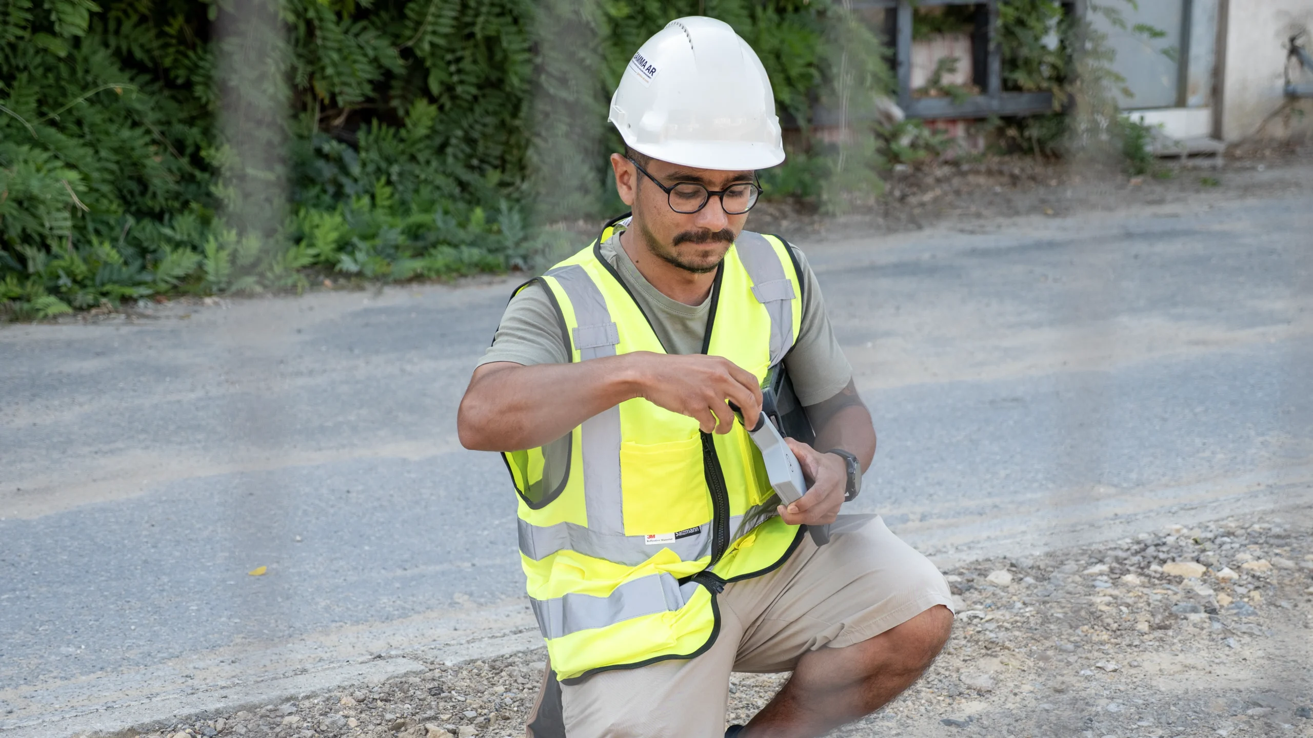
GAMMA AR works with both Leica Geosystems FLX100 Plus and Vigram viDoc devices.
“We started working with Vigram, as they are very open for collaboration,” says Jayan. “Their device is slim and easy to mount on tablets and smartphones, as well as having very interesting pricing. But most importantly, it allows users to connect GAMMA AR directly to the device without an additional App, which makes the setup preconfigurable and easy to use”
The Leica FLX100 Plus connects to Leica’s Zeno Connect app, where users can easily configure NTRIP settings and select the appropriate coordinate system.
GAMMA AR then receives a live GNSS data stream from the Zeno Connect app.
Within GAMMA AR, users can either:
- Set up a custom coordinate system using EPSG codes or WKT definitions, or
- Use the coordinate system already selected in the Leica app.
This streamlined integration ensures accurate georeferencing with minimal setup effort.
The Future of AR in Infrastructure Construction
The integration of GNSS into GAMMA AR marks a major milestone in bringing precision and scalability to outdoor construction workflows.
“Companies using the tool have already identified major construction errors within just weeks of adoption,” shares Jayan.
With the foundation now in place, the team is focused on expanding support for more devices and enhancing compatibility across diverse field conditions.
“Our next step is to analyze the setup our users are working with and identify the challenges they face in order to continue improving their experience,” Jayan adds.
As infrastructure projects grow in scale and complexity, GNSS-powered AR is paving the way for more accurate, efficient, and error-free construction, transforming how the industry builds the future.